Page updated at: 
If this page needs to be updated, please send me an email at mike@mikewalsted.com
Weather Graphics for Dallas - Fort Worth
NWS WWs Convective Sigmets Obscuration Airmets NEXRAD IMC/MVMC Areas Forecast IMC/MVMC Areas Satellite Imagery Surface Analysis Surface Forecast TFR

Severe Weather Advisories
NWS WWs Convective Sigmets Obscuration Airmets NEXRAD IMC/MVMC Areas Forecast IMC/MVMC Areas Satellite Imagery Surface Analysis Surface Forecast TFR
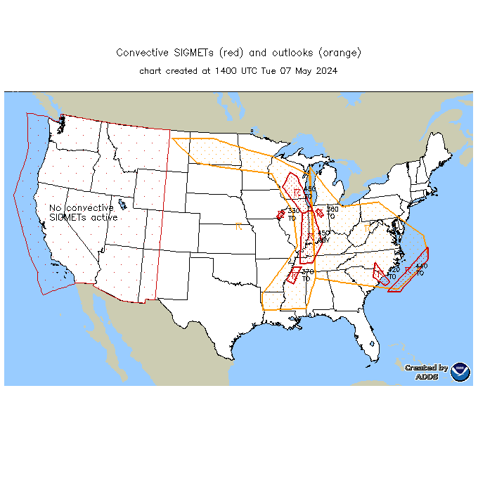
Convective Sigmets and Airmets
NWS WWs Convective Sigmets Obscuration Airmets NEXRAD IMC/MVMC Areas Forecast IMC/MVMC Areas Satellite Imagery Surface Analysis Surface Forecast TFR

IMC/Obscuration Airmets
NWS WWs Convective Sigmets Obscuration Airmets NEXRAD IMC/MVMC Areas Forecast IMC/MVMC Areas Satellite Imagery Surface Analysis Surface Forecast TFR

Base Reflectivity from NWS (official)

Base Velocity from NWS (official)
NWS WWs Convective Sigmets Obscuration Airmets NEXRAD IMC/MVMC Areas Forecast IMC/MVMC Areas Satellite Imagery Surface Analysis Surface Forecast TFR

Areas of MVMC and IMC
NWS WWs Convective Sigmets Obscuration Airmets NEXRAD IMC/MVMC Areas Forecast IMC/MVMC Areas Satellite Imagery Surface Analysis Surface Forecast TFR

Forecast areas of Flight Hazards (top) and precipitation (bottom)
NWS WWs Convective Sigmets Obscuration Airmets NEXRAD IMC/MVMC Areas Forecast IMC/MVMC Areas Satellite Imagery Surface Analysis Surface Forecast TFR


Satellite Imagery
NWS WWs Convective Sigmets Obscuration Airmets NEXRAD IMC/MVMC Areas Forecast IMC/MVMC Areas Satellite Imagery Surface Analysis Surface Forecast TFR

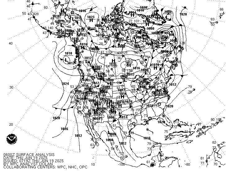
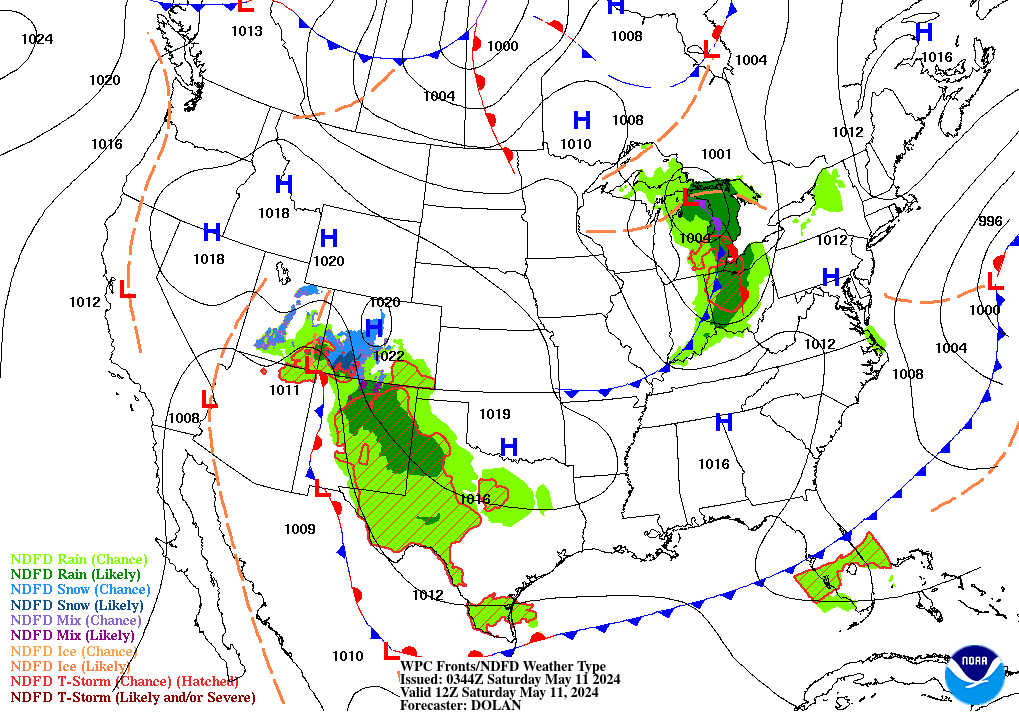
Surface Analysis
NWS WWs Convective Sigmets Obscuration Airmets NEXRAD IMC/MVMC Areas Forecast IMC/MVMC Areas Satellite Imagery Surface Analysis Surface Forecast TFR